
Through June and July 1861, the armies of Union Maj. Gen. Robert Patterson and Confederate Brig. Gen. Joseph E. Johnston shadowboxed across the lower Shenandoah Valley. They fought a few incidental skirmishes, but no major battles. The stakes were high: the Shenandoah was a fertile valley rich in grain and foodstuffs, and it served as a north–south corridor for men and supplies.
Early that summer, the Confederacy settled on a strategy of mutual defense. From Winchester, Johnston could readily reach the Manassas Gap Railroad and reinforce P.G.T. Beauregard at Manassas Junction, which he did on July 20–21. That maneuver helped tip the scales at Bull Run and carried the day for the Confederacy. Patterson’s mission was to make sure it didn’t happen. Though not entirely his fault, his failure to prevent it contributed to the Union disaster at the Battle of Bull Run.
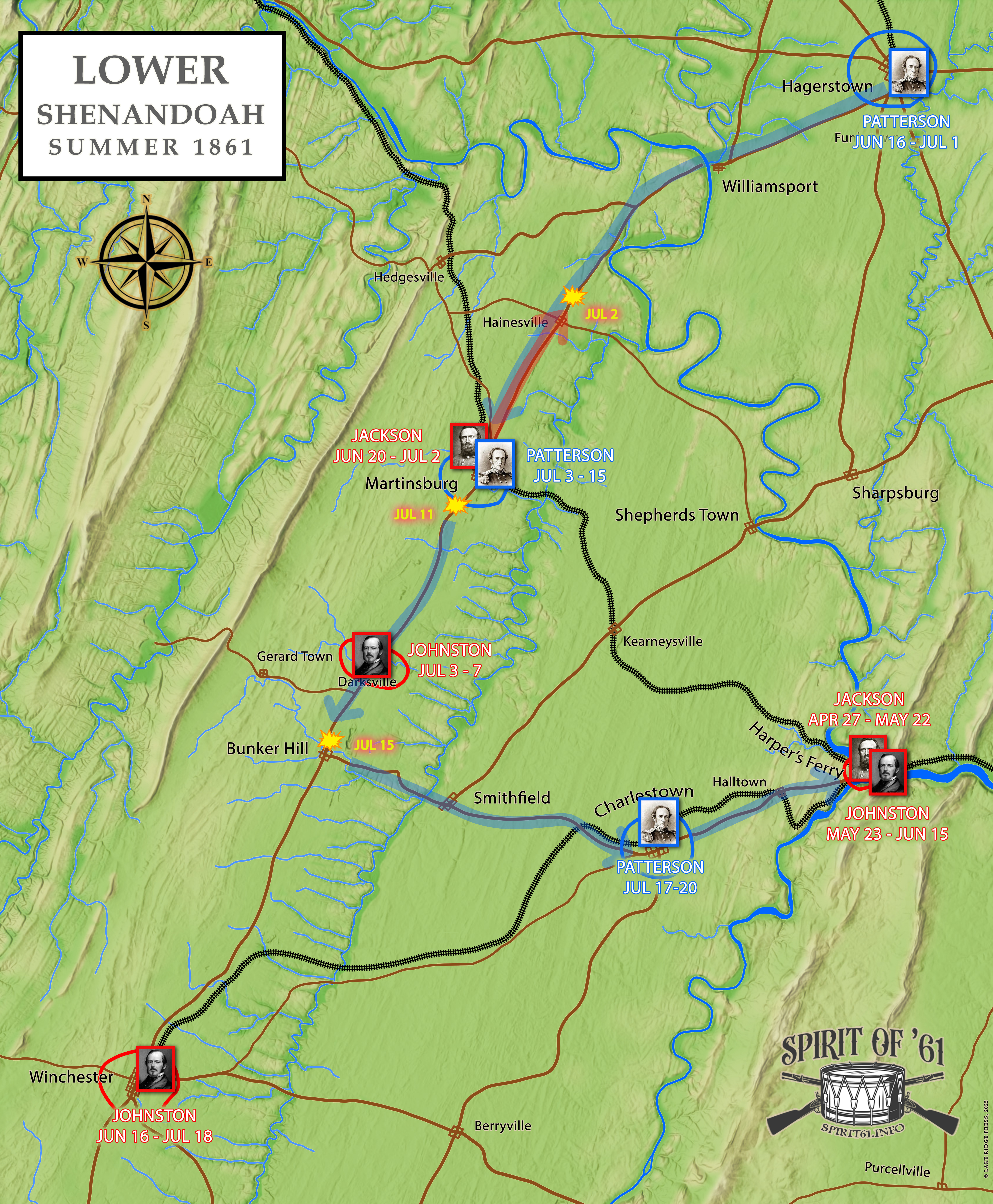
Our map of the Lower Shenandoah Campaign in the summer of 1861 shows the major movements Johnston and Patterson made from May through July, along with their relative positions along the way. It would be difficult to capture every move and countermove from that period on a single map. Nevertheless, we hope it helps visually explain what we’ve been discussing in our articles over the past several weeks.
