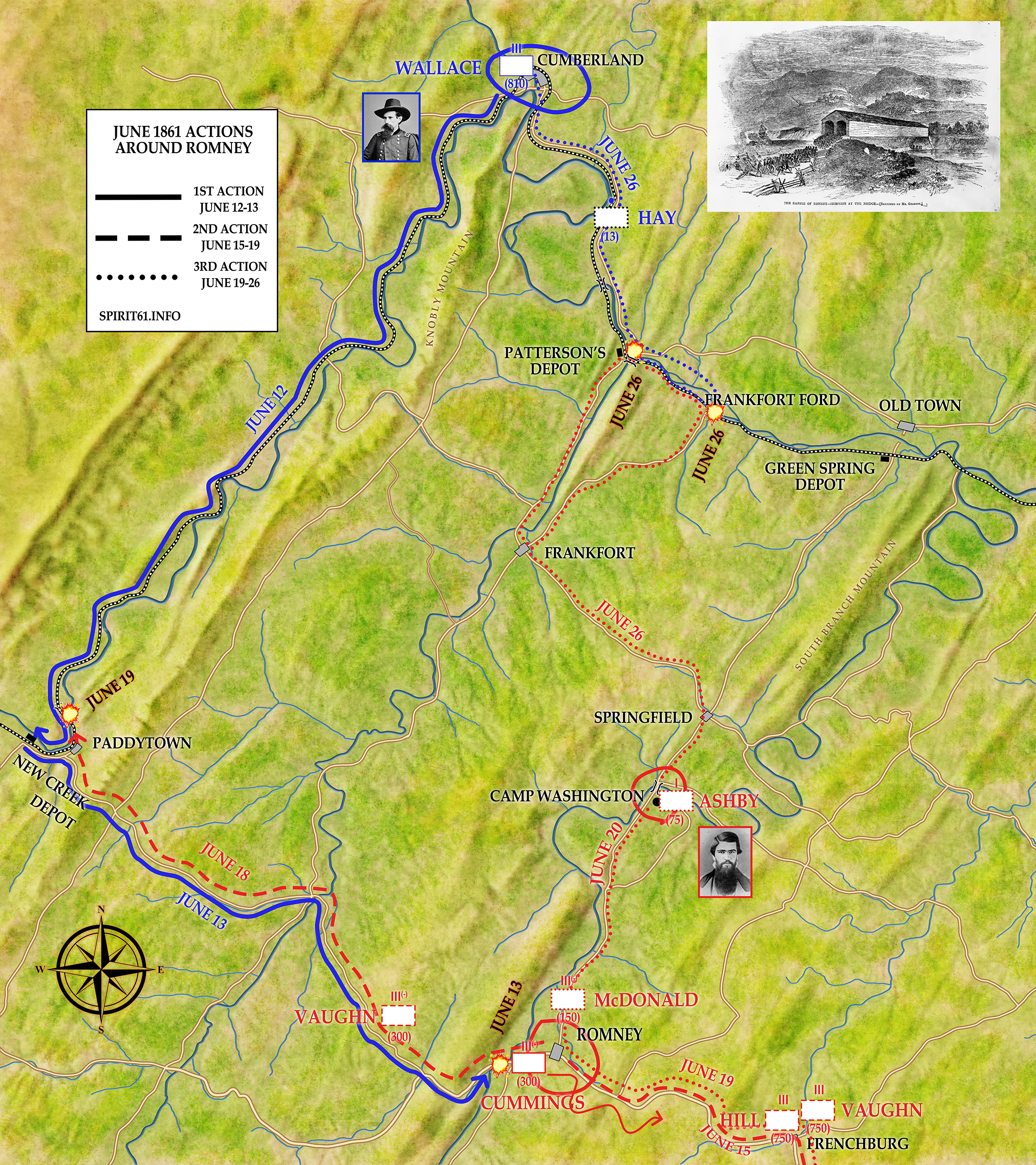
I’m proud to announce our first official map–depicting the actions around Romney, Virginia (today, West Virginia) in June 1861, which pitted Lew Wallace’s Indiana zouaves against a variety of Confederate forces sent to secure the area. Romney was a hotbed of secessionist support and Confederate forces there threatened the Baltimore & Ohio Railroad, which Lew Wallace was tasked to protect.
Depicting the various Confederate units moving into the area made things complicated and I hope it’s not too confusing. I used three different lines (solid, dashed, and dotted) to distinguish between the three separate actions: the Engagement at Romney on June 13, Action at New Creek on June 19, and the Skirmish at Frankfort Ford and Patterson’s Creek on June 26.
Click here for the large file if you’re having trouble reading the map. What do you think? Leave your comments below.