
At the end of June 1861, a small expedition of Alabama and Virginia troops scouted the southern approaches to Shuter’s Hill and Alexandria, which Union forces had occupied since May. Captain Walter H. Weems’ force included 48 men from the 6th Alabama Infantry Regiment and 10 cavalrymen from the Governor’s Mounted Guard and Goochland Cavalry. Guarding this area were skirmishers from the 4th Pennsylvania Volunteer Infantry (3 Months).
A brief but deadly firefight erupted. But where? Some contemporary newspaper reports led us to believe this clash occurred near Shuter’s Hill. Until recently, we have been calling it the “Action at Shuter’s Hill.” But then, we discovered an article in the Atlanta Southern Confederacy that included a hand-drawn sketch and Weems’ official report. The sketch specifically showed the intersection where this fight took place.
Today, this is the intersection of Telegraph and Franconia roads, across from Jefferson Manor Park. It is less than a mile and a half south of Shuter’s Hill. Edward T. Wenzel, in his Chronology of the Civil War in Fairfax County, calls it the “Skirmish at Pike’s Creek,” after a creek (today, Pike Branch) that runs parallel to Telegraph Road from Cameron Run.
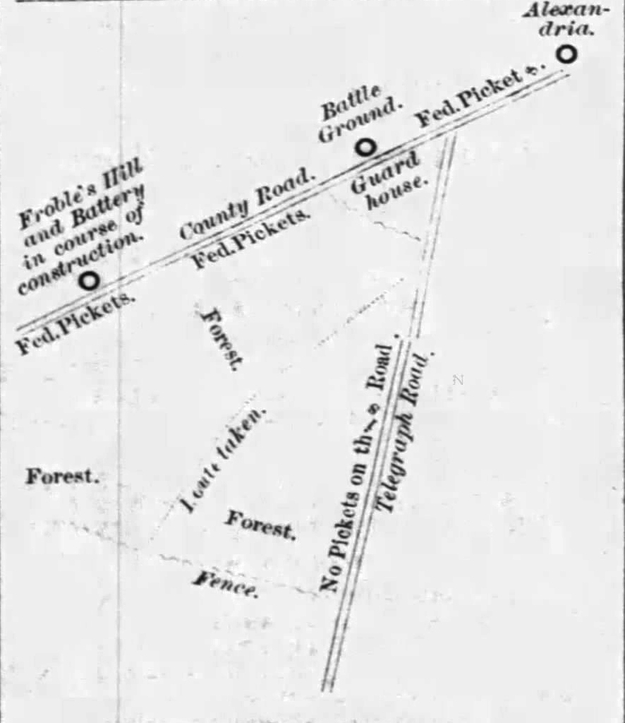
Two contemporaneous maps show this area in some detail. Below, an 1862 map of northeastern Virginia, courtesy of the Library of Congress Geography and Map Division, shows the locations of Alexandria, Fort Ellsworth, and Shuter’s Hill. Fort Lyon, in the center of this image, was built following the Battle of Bull Run. Just west of it is the intersection depicted on Weems’ sketch. Further west, you can see “Frobes” and some kind of fortification. That is the location of the battery Weems labeled as “under construction.”

Weems placed Froble’s Hill and the battery on the north side of the road, but it was to the south. The following undated Civil War-era map shows this intersection in more detail, including the location of Miss Frobel’s house south of the road. Anne S. Frobel lived there most of her life and kept a diary during the Civil War.

Using all of these sources, we have created a map depicting the Action at Pike’s Creek and the terrain as it likely looked in June 1861. This may be adjusted as new information comes to light.

Sources
Frobel, Anne S. The Civil War Diary of Anne S. Frobel of Wilton Hill in Virginia. McLean, VA: EPM Publications, Inc., 1992.
Southern Confederacy (Atlanta, GA) 19 July 1861.
Wenzel, Edward T. Chronology of the Civil War in Fairfax County, Part I. CreateSpace: By the Author, 2015.
